
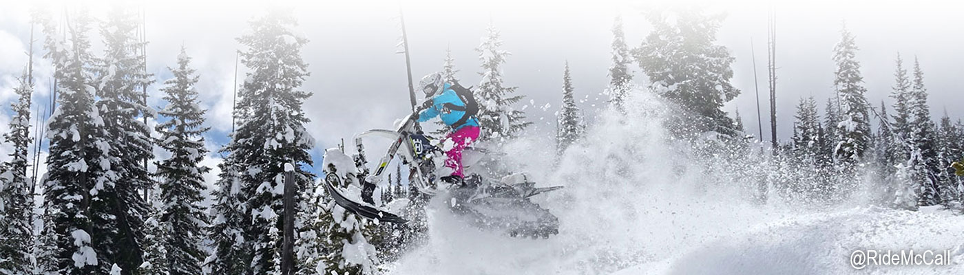
About The Area
Located in central Idaho, our area includes many small town and communities and offers an abundance of outdoor recreational opportunities no matter the preferred flavor of recreation. Not just off-roading, snowmobiling, and mountain biking but also skiing, snowboarding, snow tubing, hiking, boating, golf, SUPing, fishing, hunting, rafting, jet boating and more. There are an abundance of restaurants, cabin rentals, hotels, camping areas and convenient stores as well as spas, grocery stores and retail stores that cater to visitors. Our area encompasses both the Payette National Forest and the Boise National Forest.
McCall, Donnelly and Cascade are our three primary towns in our high mountain valley which is about 100 miles north of Boise, Idaho. The official county for all three towns is Valley County with McCall at the north end, Cascade near the south end and Donnelly in the middle. Northwest of McCall is New Meadows and then the rustic backcountry towns of Secesh and Warren are North of McCall. East of Cascade is Warm Lake and south there is Smith’s Ferry.
McCall sits on the south end of Payette Lake which and is surrounded by mountain peaks on three sides that reach into the 8000 feet range. McCall’s elevation is right around 5,000 feet above sea level or about 1 mile high as you will often see referenced throughout the town.
Donnelly, just 10 miles south of McCall and is at the north end of Cascade Reservoir. Riding areas are accessible to both the east and west side of the valley.
Cascade is 20 miles south of McCall at the southern end of Cascade Reservoir. Riding areas are accessible to both the east and west side of the valley.
Secech is about 35 miles north of McCall on Warren Road. It is a small community with many cabins, its own fire department and a restaurant with dry cabin rentals. It is accessible by regular auto in the warm months and by snowmobile or tracked vehicle in the snowy months.
Warren is a historic minding town another 10 miles past Secesh or 45 miles north of McCall and has restaurant, air strip and numerous cabins. It is accessible regular auto in the warm months and by snowmobile or tracked vehicle in the snowy months.
New Meadows also provides access to the same riding areas that are popular just north of McCall as well other riding areas out of the Smokey Boulder area into the Seven Devils mountain peaks.
Warm Lake is east of Cascade and is a high mountain lake with two resorts including restaurants and cabin rentals. Warm Lake is surrounded by backcountry riding opportunities with paved road access year round.
Smith’s Ferry south of Cascade on Highway 55 sits on the banks of the Payette River. It provides access to groomed snowmobile trails in the winter and to the high country via forest roads in the warm months. It’s also a popular take out spot for whitewater rafters and kayakers coming down the Payette from Cabarton Road.
Riggins, north of McCall about 45 minutes, sits at a much lower in elevation but is another outdoor mecca in close proximety to McCall. Riggins sits on the banks of the famous Salmon River (the River of No Return) and is considered the “Whitewater Capital of the World” by many! Jet boating, rafting and kayaking are very popular here as well as hunting.
Climate
McCall has four seasons to recreate in. McCall has the highest average annual snowfall in the state of Idaho with an average of 300+ inches at higher elevations and 135 inches in town. Average high temperatures range from the low 20’s through the 30’s November through March (with lows in the teens) and up into the mid 80’s during the summer months. Lakes around McCall warm up to pleasant temperatures mid to late summer.
While summertime and wintertime are the most popular times of year for tourists and recreationists, the fall season is often the best time of year for off-roaders, mountain bikers and hikers to get out and enjoy the quieter, more colorful trails and backcountry. Springtime often offers snowmobilers, snow bikers and UTVs with tracks perfect conditions for really reaching backcountry that might not be accessible during previous months.
For the current 7-day forecast, follow this link: 7-Day Forecast for Latitude 44.91°N and Longitude 116.11°W (Elev. 4990 ft).